
OUR SERVICES
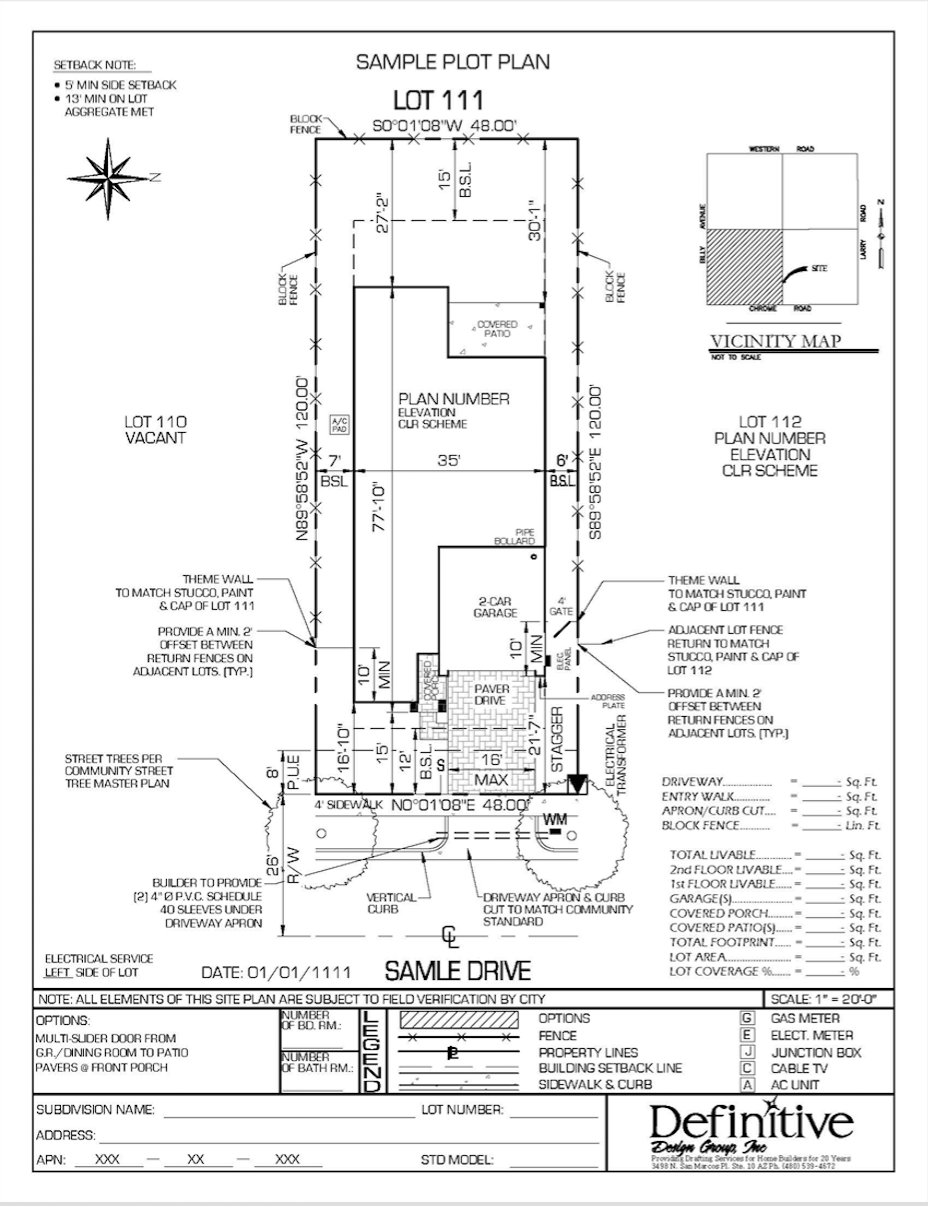
Plot Plans
An architectural drawing depicting the site of a proposed or existing lot. It is a bird’s eye view of a property that is drawn to scale. A site plan usually shows a building footprint, property boundaries, Distance between building and property lines(setbacks), parking lots, driveways, surrounding streets, landscaped areas, easements, ground sign locations, drainage facilities, sewer lines, and water lines.
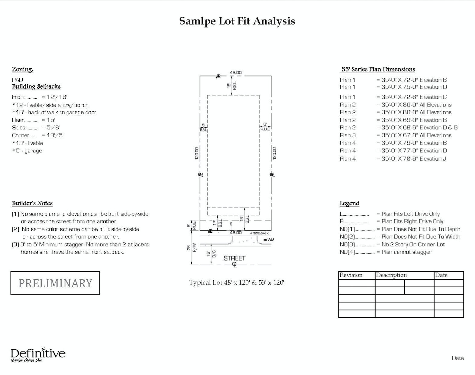
Lot Fit Analysis
Identifies the fit of each standard plan for all lots, showing lot square footage and lot coverage percentages. It includes all possible options for each standard plan.
Base Lots
An architectural drawing which illustrates each lot’s dimensions, prior to construction of a home on the lot.
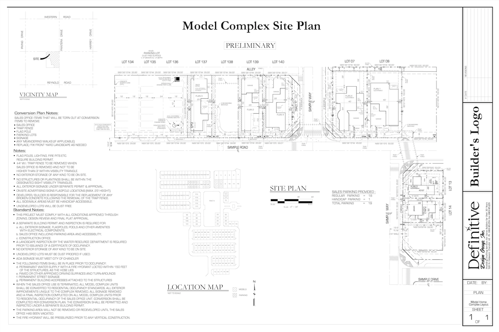
Model Home Complexes
Includes residential units, a sales office, and parking lots in a development which is being used to illustrate the design of the units to potential homebuyers during initial sale of units. A Model Home Complex is a temporary real estate office that may be established within the boundaries of an approved tract and may be used solely for the first sale of homes.
Street Scene Articulation Exhibit
An exhibit that demonstrates sufficient façade articulation of all standard plans in a plat.
Footprints
The dimensions of the total covered area of the home including garages and porches. Most subdivision lots have “Setback” requirements and “Easements”. Setback requirements stipulate how far back from the street your home can be set. There may be both a minimum setback and a maximum setback. Easements are areas included on your lot for which the utility companies have access for power, sewer and/or drainage lines to service your home and/or the homes around you.
Mylar
A transparent copy of a footprint used in conjunction with the base lot to lay out home placement.
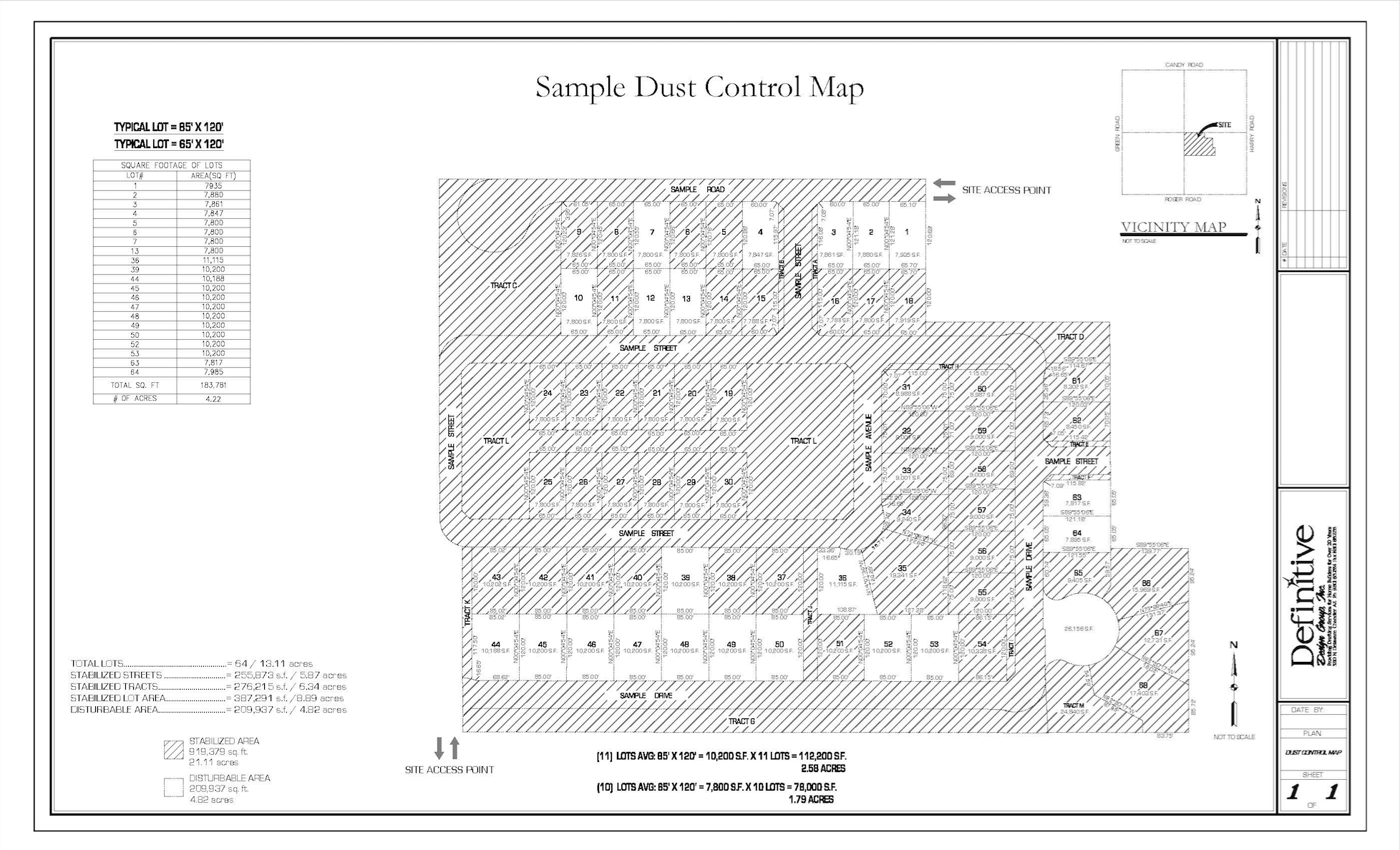
Dust Maps
Exhibit and table of total lots in a subdivision which display the open disturbable lots and the stabilized lots. Map also indicates square footage, acreage and average lot size of disturbable vs. stabilized area.
Subdivision Display Plat
A map, drawn to scale, showing the divisions of a piece of land. It is used to identify boundaries, easements, flood zones, roadway, and access rights of way. It is the legal description of a specific piece of real property and is required if land is to be subdivided for building homes, creating parks, and setting aside rights of way.